Improving Crop Management through Remote Sensing
Satellite technology provides invaluable data that allows scientists to observe growth trends, study yield gaps and target technology and inputs to increase agricultural productivity. A collaboration between CSISA and Stanford University, U.S., is exploring how remote sensing-based information can help increase wheat yields in the eastern Indo-Gangetic Plains (IGP).
Wheat is a staple crop in northern India, providing approximately 20 percent of household calories. India’s ability to provide enough wheat for its growing population over the coming decades, however, is uncertain given that wheat yields have stagnated and are predicted to decrease due to warming temperatures. Yet, farmers may be able to improve yields by altering their management strategies, like shifting sowing dates or more appropriately targeting inputs. Doing this may help narrow the existing yield gap; some studies estimate that wheat yields are approximately 50 percent of what could be achieved with optimal management practices.
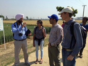
In early March, David Lobell (first from right) and Meha Jain (third from right) from Stanford University, US, visited CSISA sites in Bihar. Stanford is acquiring high resolution remote sensing data for some CSISA sites to validate their yield prediction algorithm and CSISA is helping them acquire ground level data through crop cuts.
With the aim of improving agronomic management practices, Stanford University is working with CSISA to use satellite imagery to better understand the causes and spatial patterns of yield gaps across the eastern IGP and target and assess the impact of CSISA’s different intervention strategies, like the introduction of zero-till machinery and precision broadcasting of fertilizer.
Satellite imagery provides a wealth of data, with which can be used to map the characteristics of farmers’ fields, like crop type, sowing date and yield across space and time. The benefit of using remote sensing of satellite images instead of conventional data collection methods (like social surveys) is that it is a low-cost way to collect information over thousands of farmers’ fields over multiple years. This data can give a historical perspective of farming practices and insight into the heterogeneity among management practices and yields across a given landscape.
As the average size of fields in the region (approximately 0.3 ha) are typically smaller than the resolution of readily-available satellite imagery, like MODIS (250 m) and Landsat (30 m), it has been difficult to map field-level characteristics of smallholder farms in the eastern IGP. To overcome this challenge, Stanford is partnering with satellite companies like Skybox and Planet Labs, which are producing and providing high-resolution data (1–5 m). These high-resolution images will be used to map characteristics of individual farmers’ fields, as well as within-field heterogeneity. Field data from CSISA has been instrumental in testing and validating the models, which researchers at Stanford are currently using to estimate sowing dates and yields using satellite imagery.
Additionally this research will use the information provided by satellite data to help understand yield trends, identify where intervention strategies may best be targeted and measure the impact of various intervention strategies through time. Specifically, it aims to map the yield of wheat across northern India and assess what factors (such as weather, seed variety, sowing date) are responsible for changes in yield through time.
This partnership will also explore the use of satellite data to map key biophysical parameters of the agricultural landscape, which can lead to effective targeting of appropriate interventions. For example, a set of villages that are persistently low yielding compared to their neighbors can be provided with appropriate inputs to help close the yield gap and enhance the production of smallholder farmers.
Written by David Lobell, Associate Professor at Stanford University in Earth System Science, Deputy Director of the Center on Food Security and the Environment and Meha Jain, Postdoctoral Research Fellow at Stanford University in Earth System Science.
Tags: GIS, Satellite, Stanford University